ETS Registration for Landowners
ETS registration for landowners is the formal process by which New Zealand forest owners enter the Emissions Trading Scheme to earn New Zealand Units (NZUs) for carbon sequestration or manage deforestation liabilities. It involves assessing land eligibility, mapping forest boundaries according to geospatial standards, and submitting an application through Te Uru Rākau – New Zealand Forest Service.
Navigating the New Zealand Emissions Trading Scheme (ETS) is a critical component of modern land management under the Zero Carbon Act. Whether you are looking to monetize a pine plantation, regenerate native bush, or manage liabilities associated with pre-1990 forests, understanding the registration ecosystem is paramount for financial and environmental compliance.
Eligibility Assessment: Qualifying Your Land
Before initiating the application process, landowners must conduct a rigorous eligibility assessment. The New Zealand ETS is specific about what constitutes eligible forest land. Entering the scheme is generally voluntary for owners of post-1989 forest land who wish to earn carbon credits, but it can be mandatory for owners of pre-1990 forest land who intend to deforest.
Understanding the nuance of your land classification is the first step in the inverted pyramid of ETS compliance. If the land does not meet the biological and spatial definitions set by the Ministry for Primary Industries (MPI), any application submitted will be rejected, resulting in lost time and consultancy fees.
What Defines “Forest Land” in the ETS?
To qualify for ETS registration for landowners, the area must meet the statutory definition of “forest land.” This is not merely about the presence of trees; it is about the geometry and potential of the vegetation. The specific criteria are as follows:
- Area: The forest must cover at least one hectare (1ha) of land.
- Width: The area must have an average width of at least 30 meters.
- Canopy Cover: The trees must be capable of reaching a height of at least 5 meters and a crown cover of more than 30% in each hectare at maturity.
It is important to note that these metrics apply to the potential of the species planted or regenerating. For example, newly planted seedlings that are currently 20cm tall still qualify if the species (e.g., Pinus radiata or Manuka) is biologically capable of meeting the height and canopy thresholds at that location.
What Vegetation is Excluded?
Not all tree plantings qualify. Shelterbelts (unless they meet specific width requirements), fruit trees, nut crops, and trees grown primarily for the production of fruit or nuts are generally excluded. Furthermore, if the land is managed primarily for grazing and the tree stocking is insufficient to suppress pasture, it may not meet the definition of forest land.
Distinguishing Post-1989 and Pre-1990 Forest Land
The single most important distinction in ETS registration is the historical status of the forest. The obligations and opportunities differ vastly between these two categories.
Post-1989 Forest Land
This is land that was not forest land on 31 December 1989, or was forest land on that date but was deforested between 1 January 1990 and 31 December 2007. Registration for post-1989 land is voluntary. Landowners register this land to participate in carbon farming, earning New Zealand Units (NZUs) as the forest grows and sequesters carbon.
Pre-1990 Forest Land
This is land that was forest land on 31 December 1989 and remained predominantly exotic forest species on 31 December 2007. You cannot register this land to earn NZUs (unless you have an exemption or are part of specific offsetting schemes). However, landowners have mandatory obligations if they choose to deforest this land (change land use). Understanding this distinction prevents costly legal errors.
The Application Process and Fees
Once eligibility is confirmed, the ETS registration process involves interacting with Te Uru Rākau – New Zealand Forest Service. The process has moved largely online, utilizing the Tupu-ake portal, but it requires significant preparation of documentation.

Step 1: Set Up an EPA Account
Before registering land, you must open a holding account with the Environmental Protection Authority (EPA) on the New Zealand Emissions Trading Register (NZETR). This is where your carbon credits (NZUs) will be deposited. This requires identity verification and anti-money laundering (AML) checks.
Step 2: Submit Application via Tupu-ake
The application to add a Carbon Accounting Area (CAA) is submitted to MPI. You will need to provide:
- Proof of land ownership (Record of Title).
- Detailed geospatial mapping (Shapefiles).
- Information on the forest type and age.
- Declarations regarding any other government funding received (e.g., One Billion Trees grants).
Step 3: Fees and Costs
ETS registration for landowners incurs specific fees. As of the current regulations, there are administrative fees for registering as a participant and for adding land areas. Additionally, most landowners require the services of a forestry consultant and a GIS specialist to prepare the application, as errors in mapping can lead to rejection.
Note on Fee Structure: MPI periodically reviews fees. Currently, there is an application fee for adding a Carbon Accounting Area, and ongoing annual fees for maintaining participation in the scheme. Budgeting for $500 – $2,000 in direct government fees and significantly more for professional services is prudent.
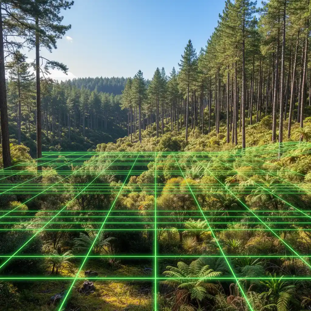
Geospatial Mapping Requirements
The most common reason for ETS registration delays is incorrect mapping. The ETS requires high-precision mapping data.
Maps must be submitted as ESRI Shapefiles and must adhere to the Geospatial Mapping Standard. This includes:
- Accurate delineation of the forest perimeter.
- Exclusion of gaps (e.g., roads, rocky outcrops, waterways) that are wider than 15 meters.
- Correct coordinate systems (NZTM2000).
- Snapping to cadastral boundaries where the forest edge coincides with the property boundary.
Because of the technical nature of these requirements,